Resource center

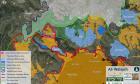


Ir Amim’s latest map, “Settlement Ring around the Old City, 2019,” graphically illustrates the accelerated, intensifying chain of new facts on the ground in the most historically contested and politically sensitive part of Jerusalem: the Old City and adjacent ring of Palestinian neighborhoods. In addition to a mounting number of state-sponsored settlement campaigns inside Palestinian neighborhoods – settler initiated evictions of Palestinians, takeovers of their homes, and the expansion of settler compounds – touristic settlement sites function as key points along a ring of tightening Israeli control.
>>> 
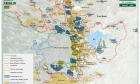
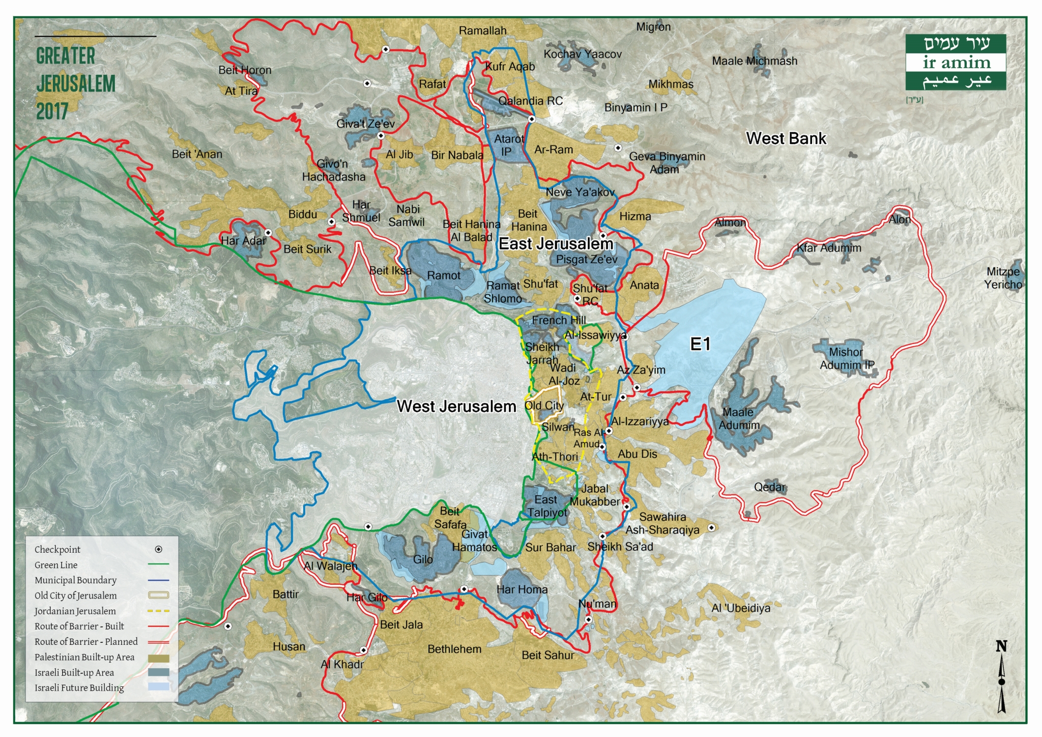
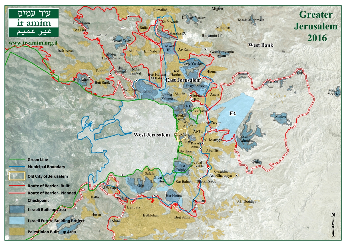
The map of Greater Jerusalem 2019 delineates the Green Line; the Jerusalem municipal boundary; the borders of historic Jordanian Jerusalem; and the route of the Separation Barrier and h
>>> 
Map showing settlements and national parks surrounding the Old City area.
>>> 

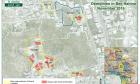
The high rate of demolitions in East Jerusalem continued in 2017, totaling 86 residential units and 87 non-residential units.
>>> 
Map showing the Green Line and the municipal boundary; the distinction between I
>>> 
Map showing settlements and national parks surrounding the Old City area.
>>> 
2016 was a peak year for demolitions, with a total of 203 units demolished: 123 residential and 80 non-residential units.
>>> 
Following Prime Minister Netanyahu's statement of January 22, 2017 about lifting restrictions on construction in East Jerusalem, Ir Amim compiled a list of building plans
>>> 
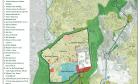
Map showing houses in Beit Hanina under threat of demolition, after Jerusalem Municipality annouced that it would advance the demolition of 14 homes in Beit Hanina, housin
>>> 
Map showing the Green Line and the municipal boundary; the distinction between I
>>> 
- 1 of 2
- next ›

Interactive map

Ir Amim on Flickr

Ir Amim channel